کشفرود و میدان گازی خانگیران
کشفرود در تاریخ ایران زمین، آبادانی داشته و بخشی از محیط زیست کشور ایرانه:
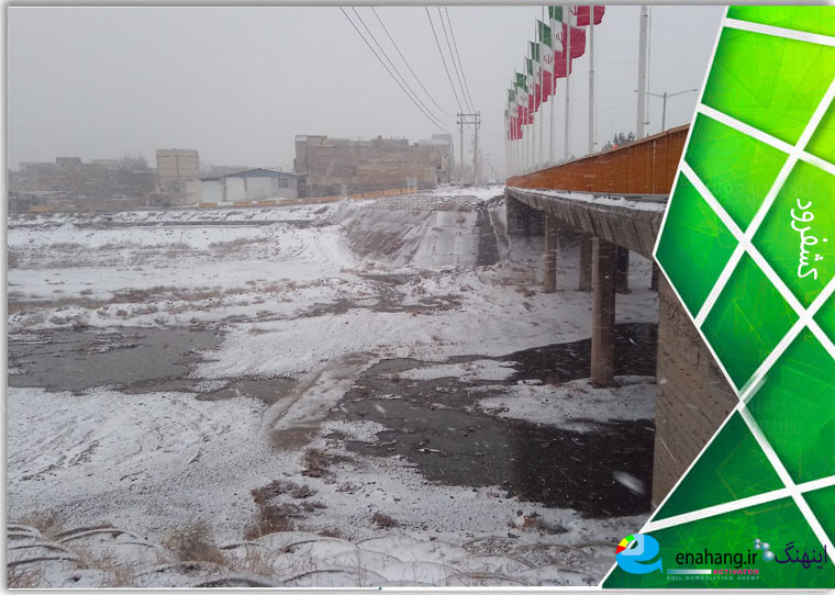
تندوره درگز و آبریز هریرود و کشفرود و زیرحوزه درونگر زیبایی های تکرار ناشدنی دارند.
مکتوبات تاریخی نشان میدهد، آصفالدوله به دستور ناصرالدین شاه قاجار، با همراهی چند فرانسوی، به بلوار شاهنامه میرود و آرامگاه فردوسی را در نزدیکی کشفرود پیدا میکند.
سرچشمه اترک نزدیک کشفرود است و اون هم با بستر گلی خشک است.
کشفرود سفالیه واین چیزی نیست که از خاصیت ژئوپلیتیکی ایران در تاریخ کم کند..
اینکه بگویند مشکل از اینجاست که شیب باعث میشه آلودگی به کشفرود جاری بشه نوعی فریبه. این مزیت ژئوپلیتیکی کشفرود است.
کشفرود با همه مزایایش در حال خشکانیدنه و مسئولین آنرا می بندند و خشک کردن آن را دنبال می کنند، همانطور که اترک را خشک کردند، اترک که تا دیروز آبادانی داشت چرا باید خشک شود؟
در بررسی علت خشکی کشفرود و اترک هم باید سرچشمه ها و هم رودهای زیرمجموعه را بررسی کنیم و وضعیت یکی به تنهایی پاسخ روشنی نمیدهد.
پاسخ زمانی بدست می آید که خشکی و وضعیت رودخانهها رو لااقل با سرچشمه های نزدیک، باهم بررسی کنیم.
بهره برداری بهینه آبی شامل زیر پروژه هایی نظیر سدهای خاكی، سد تیرگان، سد خاكی كلات، و تصفیه آبی درگز، بند انحرافی درونگر و آب بندانهای ایدلیك و لائین است
اکنون در جستجو ها بجای آنکه دانشمندان درباره جلوگیری از خشکی بیشتر و کشفرود صحبت کنند، نویسندگانی دیده میشوند که کشفرود را ریشه مشکلات معرفی می کنند و رسانه های مکتوب هم که درآمدشان از سیاسی ها آمده است حرف آن نویسندگان را تکرار می کنند. وقتی نویسنده دانشگاهی سیاستزده میشه، از بیان حقایق علمی دور میشود و برای رسیدن به سیاست از گزاره های علمی استفاده می کند، در نتیجه نوشته او چرت و پرتی بیشتر نیست. دانشجویی رو طوری طراحی و تعریف می کنند که خشکرود تعریف کنند تا به سیاست شامل نابودی درختها و سایر جانداران که حیاتشان به کشفرود وابسته است برسند.
از طرفی برخی تحقیقات هم سیاست اقتصادی آنها را نشان میدهد که کشفرود میتواند مانع رسیدن به آن باشد. اینجا میخواهم کمی از این نوشته ها را بیان کنیم:
زمین رسوبی کشفرود از نظر ليتولوژي شامل ماسه سنگ ها و شيلهاي با فسيلهاي گياهي است كه بطور وسيع در بستر سفلاي كشفرود در جنوب كپه داغ بيرونزدگي دارد
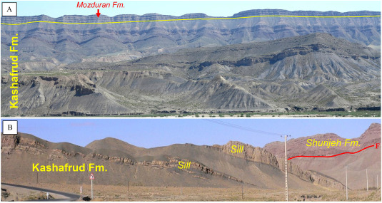
لايه هاي کشفرود مواد آلي فراواني دارد و پذيرفته شده که گاز خانگيران از سازند کشفرود است.
ليتولوژي سازند کشفرود پيريتي آمونيتدار، و لايههاي آهكي است.
سازند سرچشمه از دهكده سرچشمه بجنورد مارنهاي خاكستري و شيلهاي رنگي آهكي اربيتولين دار لايهاي دارد. در حد زيرين آن سازند تيرگان قرار دارد كه گاه با آن حالت بين انگشتي داشته است و در حد فوقاني آن نيز بك لايه كليدي آهك صدفدار با آمونيتهاي آپسين بالايي وجود دارد كه قله سازند سرچشمه بشمار مي رود و سازند سنگانه به طور همشيب روي آن ديده مي شود. سن سازند سرچشمه، آپسين (زيرين و فوقاني) تعيين شده است.
__________________________
Kashfarud has been a prosperous land in the history of Iran and is part of the Iranian environment
A beautiful land
The Dargaz Tandoureh, the Harirud basin, the Kashfarud, and the sub-basin of the Indanghar have unrepeatable beauties.
Historical documents show that Asef al-Dawlah, on the orders of Nasser al-Din Shah Qajar, accompanied by several Frenchmen, went to Shahnameh Boulevard and found the tomb of Ferdowsi near the Kashfarud.
The source of the Atrak is near the Kashfarud, and it is also with a dry mud bed.
The Kashfarud is a clay pot, and this is not something that reduces the geopolitical significance of Iran in history.
To say that the problem is here that the slope causes pollution to flow into the Kashfarud is a kind of deception. This is the geopolitical advantage of the Kashfarud.
The Kashfarud, with all its advantages, is drying up and the authorities are closing it and pursuing its drying up, just as they dried up the Atrak. Why should the Atrak, which was prosperous until yesterday, dry up?
In investigating the cause of the drought of the Kashfrud and Atrak rivers, we must examine both the sources and the sub-rivers, and the status of one alone does not provide a clear answer.
The answer is obtained when we examine the drought and the status of the rivers, at least together with the nearby sources.
Optimal water utilization includes sub-projects such as earth dams, Tirgan Dam, Kalat Dam, and Dargaz water purification, the Darongar diversion dam, and the Idlik and Lain dams.
Now, instead of scientists talking about preventing further drought and Kashfrud, writers are seen in searches who introduce Kashfrud as the root of the problems, and the written media, whose income comes from politicians, repeat the words of those writers. When an academic writer becomes politicized, he moves away from stating scientific facts and uses scientific statements to achieve politics, as a result, his writing is nothing more than a blur. They design and define a student in such a way that they define Khoshkrud in order to achieve a policy that includes the destruction of trees and other organisms whose lives depend on the Kashfrud.
On the other hand, some research also shows their economic policy that Kashfrud can prevent it from being achieved. Here I would like to cite a few of these writings:
The Kashfrud sedimentary land in terms of lithology consists of sandstones and shales with plant fossils that are widely outcropped in the clay bed of Kashfrud in the south of Kope Dagh
Kashfrud gas field
The Kashfrud layers have abundant organic matter and it is accepted that the Khangyaran gas is from the Kashfrud formation.
The lithology of the Kashfrud formation is ammonite-bearing pyrite, and calcareous layers.
The Sarcheshmeh formation from the Sarcheshmeh village of Bojnourd has gray marls and colored calcareous shales with orbitulin. At its lower limit is the Tirgan Formation, which sometimes has an interdigital form with it, and at its upper limit there is a key layer of shelly limestone with Upper Apsian ammonites, which is considered the top of the Sarcheshmeh Formation and the Sanganeh Formation is seen in a parallel manner on it. The age of the Sarcheshmeh Formation has been determined to be Apsian (lower and upper).